
You heard about those GIANT x16…x64 maps haven’t ya all?
– unknown
These types of Farming Simulator maps are still ‘hot’ topics among modders and players—just because they are reasonable larger than the vanilla maps GIANTS put time and money into, just to have their product validated by Sony Corporation and Microsoft Gaming. Still, in 2025, GIANTS Software sticks to maps usually 2049×2049 pixels in width and length due to the compatibility for game consoles, that supposedly can’t deal with ‘high complexity of computer graphics’ where the hardware need to ‘compute’ the alignment of vector graphics (which the cube below is made of).
PC hardware is supposedly more robust in dealing with such complexity, although PlayStation 5 is quite strong for real-time rendering, which is what game engines and hardware do.
So you may ask yourself: Why not larger maps for Farming Simulator?
To this day, this is something that modders do when GIANTS don’t.
This guide will teach you about the size and scale of things. So, let’s start with units.
Units
Now, within GIANTS Editor, the Y-axis points upwards towards the sky, while the X- and Z-axes point left and right. This coordinate system is also found in 3D editing software like Blender. In GIANTS Editor, we typically work with a measurement called units. The grid plane within the editor is 1×1 units, represented by a cube primitive measuring precisely 1x1x1 units in width, length, and height, as illustrated below.
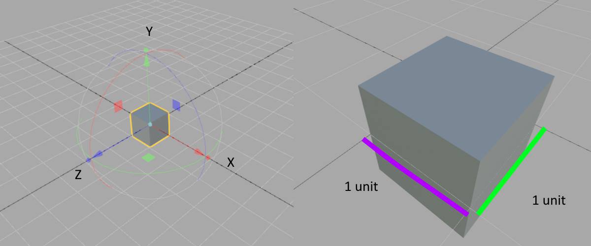
The scale of this cube is one (1) unit for all XYZ. If we take a look at the Attributes Panel inside the editor,
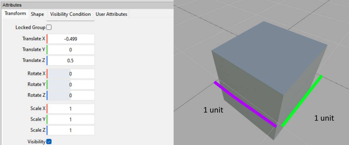
If we scale the XYZ = 2, we’ll have a 2x2x2 unit cube. That’s what units are for a cube primitive inside the editor.
Now let’s move over to a 3D editor software known as Blender.
One unit is one meter *BINGO!*
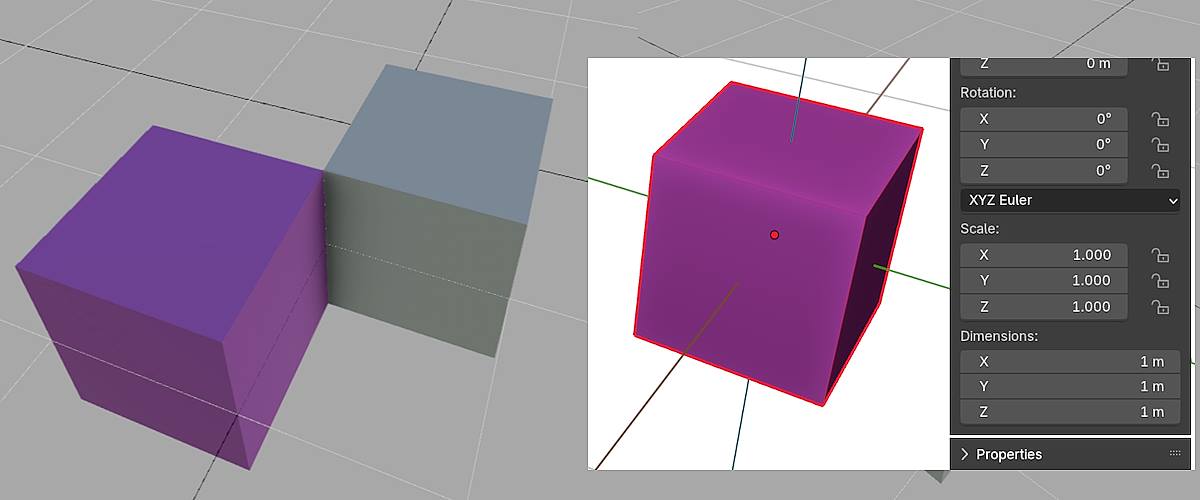
In Blender, I created a 1x1x1-metre cube and exported it to an I3D file, which I then imported into the GIANTS editor. Therefore, we can confidently state that one unit equates to one metre, which is also one square meter.
There’s no magic to this other than what I’ve illustrated. So let’s move over to pixels then…
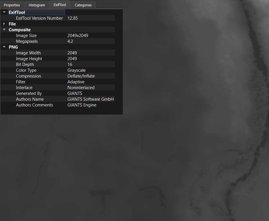
Pixels (dem.png)
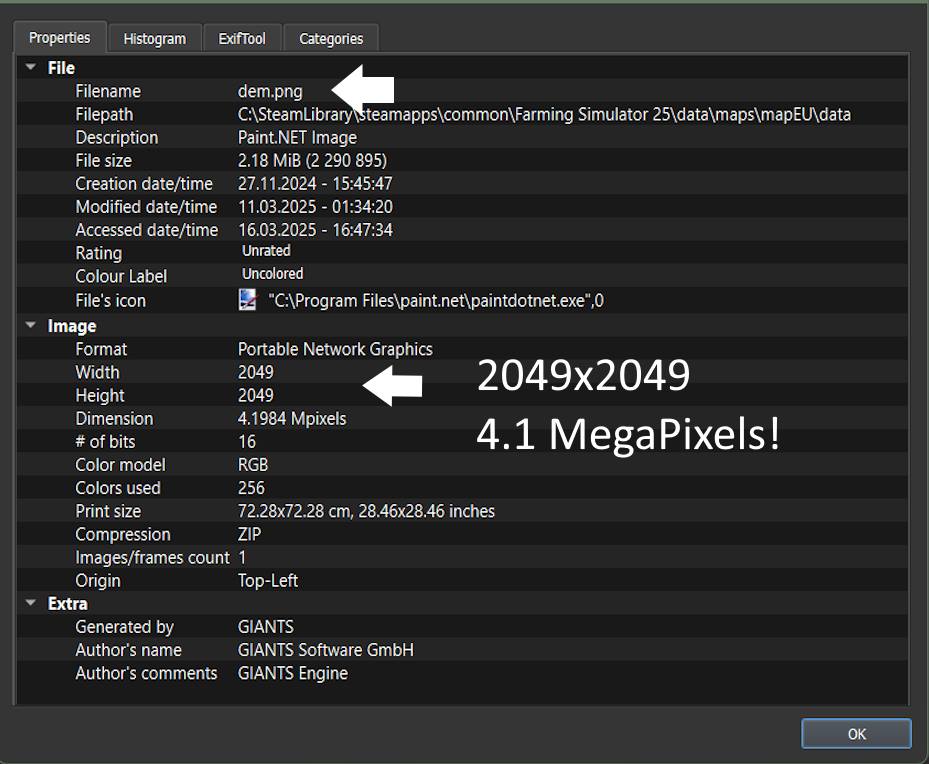
What we are looking at above, is the file properties for a so-called dem.png. PNGs are used by GIANTS Engine mainly for layers, and can also be used for general texture maps such as albedo/diffuse, normal and so on. PNG is the short name for Portable Network Graphics, which is commonly used for textures or other visual 2D data (we are still talking about vector graphics here), where the color information (per pixel) is translated into what is more or less a heightmap. We can also use height maps in Blender to manage the elevation of each vertex for a surface/3D mesh. Usually, this is referred to as the topography among 3D artists and professionals who work with 3D graphics.
The picture below is the dem.png for the Zielonka (vanilla map) for Farming Simulator 25. It’s a 16-bit grayscale texture that decides the elevation of the terrain surface we find inside the Scene Graph of GIANTS Editor when we open the map to visually look at it.
Okay…so now what?
Those 2049×2049 pixels could easily be translated to 2049×2049 metres. It’s not so far from the truth.
By opening the map inside GIANTS Editor and looking at the attributes for the terrain, we see that units per pixel are set to one (1).
Units per pixel – The Upper Hand
The units per pixel are to be considered the ‘upper hand’ above the dimensions of the dem (dot) PNG of 2049×2049 pixels since they now also represent one metre per pixel. All that are changed to the units per pixel will do the math. But I will do this by using my Blender cube yet again, simply by…
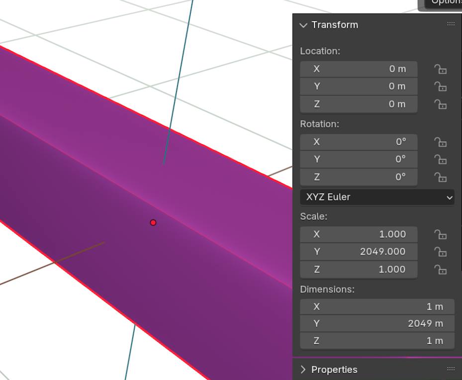
I’m changing the dimension of my cube to 2049 meters in the Y-direction (which would be the width or length/left or right in GIANTS Editor), and then exporting and importing. But I’m going to add some more width (100 meters) to this one so we can see it.
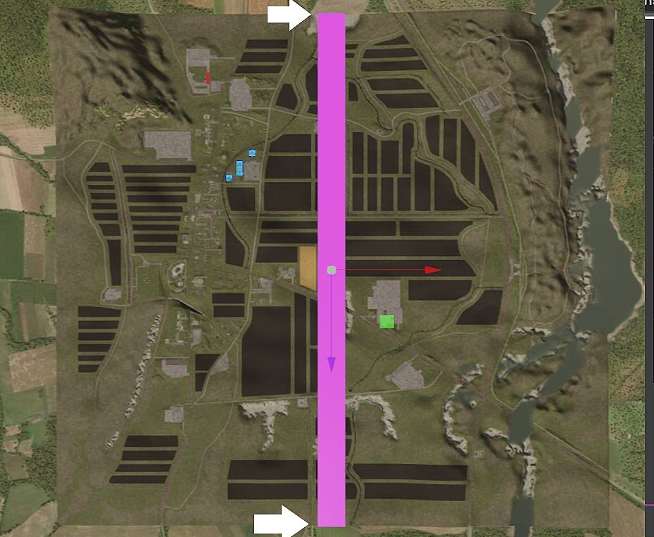
As we can see, the cube is reaching the map’s end borders. This screenshot is from the Top View inside GIANTS Editor. And the magic?
There’s no magic to larger Farming Simulator maps
If I were going to tell you exactly why, I would. We can conclude that the whole thing about these enormous maps for Farming Simulator is a gross, comical hype that some YouTube influencer made into a clickbait headline. They are very good at doing so when it’s not that big of a deal.
Let’s be honest: The relationship between units, meters, and pixels is precisely as it should be. Because what is changing the scale of a map (which is the terrain surface itself) is:
- Units per pixel
- The number of pixels inside the dem (dot) PNG.
Those two are in a close relationship, which will determine the length and width of a map in meters. Now, 2049 meters is 2.04900 kilometers in its most absolute value. If I were to decide the appropriate wording for such a map, it would be a two-kilometer map. But in the hyped language, it would be an X2 or 2X map.
It’s just about how we define and say things.
If my neighbor measures 2 meters from feet to head, he would be classified as a 2X person….
Most Farming Simulator gamers will probably look for things in a modded map other than the size of ‘the landscape’. Larger maps can be excellent for mountainous scenery or multiplayer with several players playing together. However, the terrain topography of such maps will either be carved out manually using landscaping tools or by converting real-world topographic terrain data. The last option may speed up the workflow, but carving out the landscape meter by meter is a lot of work. And if that alone wasn’t all, each layer for all terrain textures needs to be upscaled. Then on top of that, all the terrain surfaces need to be painted.
These are things to consider when making a modded map for Farming Simulator.

If my neighbor measures 2 meters from feet to head, he would be classified as a 2X person….–Erik Nikolai